Pyrford to The Thames |
Introduction
The final walk alongside the River Wey Navigations pases through Pyrford, New Haw, Addlestone and Weybridge to the rivers junction with the Thames on the outskirts of Weybridge. It could be extended by walking part of the Thames Path from Weybridge.
Getting to the Start
Pyrford Lock is a short distance from the town of West Byfleet. From the town centre turn down Pyrford Road (with Barclays Bank on your right) and continue along this road out of the town and take the left turning (Lock Lane) after about a mile. This road crosses over the lock (on a narrow road) and free parking is available just after crossing the lock on the right by the pub. The lock is also easy to reach from the A3. On the London bound carriageway exit at the junction signed for Wisley RHS Gardens and follow the signs to Wisley Village (not the gardens). Pass through the village and the road comes towards Pyrford Lock. The car park is opposite the pub on the left hand side of the road. If you're coming on the A3 from London you'll need to continue onto the Ripley Junction (the next junction after the M25) and join the London-bound carriageway to access the Wisley turning.
By public transport, the nearest town is West Byfleet. Countryliner bus service 437 operates hourly (Monday - Saturday only) from Woking, West Byfleet and Chertsey (all of which have stations) to the end of Lock Lane, a short walk to the lock. If the bus isn't running or you prefer to walk Pyrford Lock is a little over a mile from West Byfleet station, which has frequent trains from London, Surbiton, Weybridge and Woking. Exit the station on the town side and continue down the road ahead, crossing another road on the left by Woolworths. At the busy junction cross over the three crossings and turn right, with Barclays Bank on your right on the other side of the street (Pyrford Road). Continue down Pyrford Road and turn right into the road called Dodd's Lane. At the end of this road by the pylon continue on the path which joins the River Wey at Dodd's Bridge just to the north of Pyrford Lock.
The Walk
Pyrford Lock is a lovely setting, with the popular Anchor Pub on the river. The path continues round the beer garden. On the left is Pyrford Mariner. Soon you come to the small Dodd's Bridge where a path continues to the left to the outskirts of West Byfleet. The river turns a bit after this bridge to come to the next bridge, Murray's Bridge. The noise of the M25 motorway now starts to become a bit intrusive to the right. Soon you get to the road bridge that carries the busy A245 on the outskirts of New Haw. Here the path briefly leaves the edge of the river, before re-joining the river at Byfleet Boat House where you can hire a boat in the summer months.
 |
| The Wey at Byfleet Boat House |
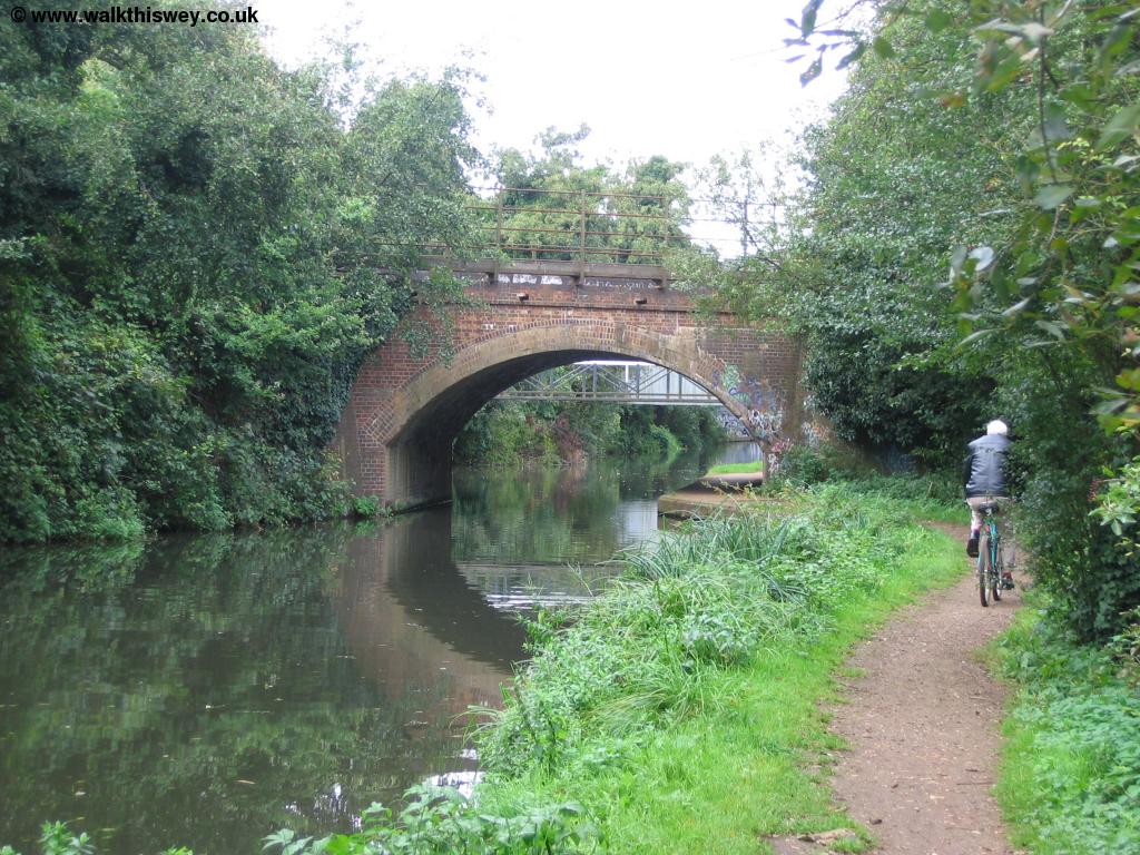
Houses now line the opposite bank of the river, whilst the M25 runs close to the other bank making this part of the path a bit noisy. Soon however a network of bridges appear ahead. The first is the railway bridge carrying the railway line towards London. Beyond that is a footbridge, providing access to the Basingstoke Canal towpath, which runs from here to Greywell near Basingstoke. Beyond that is another metal footbridge, then the enormous bridge above that carries the M25 motorway over the river.
 |
 |
| The railway bridge across the river | The M25 crosses the river |
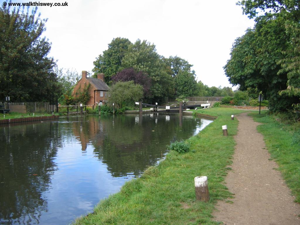
Once under the large bridge of the M25 peace begins to return to the river, which has residential buildings backing onto the river on the left. Soon you come to picturesque New Haw lock with the traditional lock keepers cottage. Beyond the lock you have to cross the road before returning to the banks of the river. Looking back to the lock gates, a torrent of water was spraying up from the lock gates a reminder of the sort of pressure these wooden gates have to cope with.
 |
 |
| New Haw Lock | Water spraying from the lock |
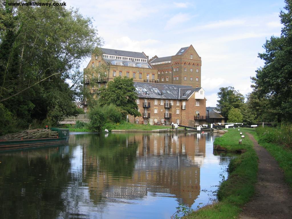
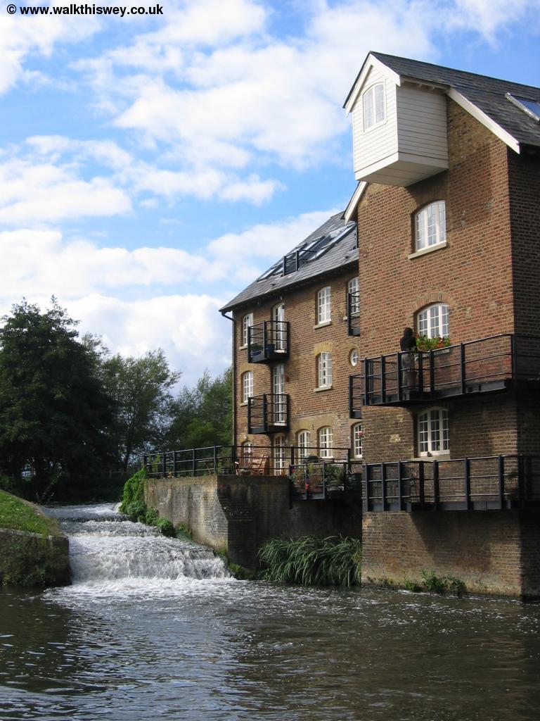
Beyond the bridge there are some industrial buildings on the right and a few houses on the left, but soon the river bank returns to a more rural setting as it turns to the right. As the river turns back to the left there is the mill pond on the left, separated from the river by a tiny strip of bank. Ahead you can see Coxes Lock, with the beautiful old mill dominating the skyline. This lovely building has now been converted into flats although the old mill stream is still there. The houses beyond mark the edge of the town of Addlestone.
 |
 |
| Coxes Lock | Coxes Lock |
 |
|
| Coxes Lock |
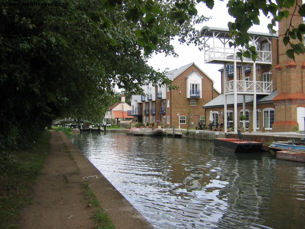
To the right of the path here are Wey Meadows the water meadows of the river. Beyond the lock the river is lined on the left side by the buildings of the Weybridge Business Park and also many boats.
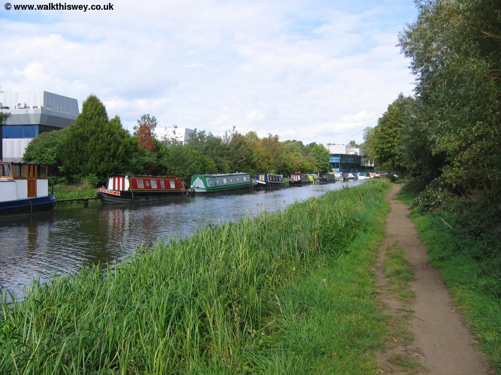 |
| The Wey by Weybridge Business Park |
As you reach the end of the business park the river turns to the right towards Weybridge Town Lock and the bridge that gives the town it's name. Beyond it is a larger road bridge. Here the original river meets the Wey Navigation, with the bridges labelled for boats. Here the path crosses a small footbridge then you cross the smaller old bridge and the busier second bridge.
 |
 |
| Weybridge Lock | Weybridge from the Wey Bridge! |
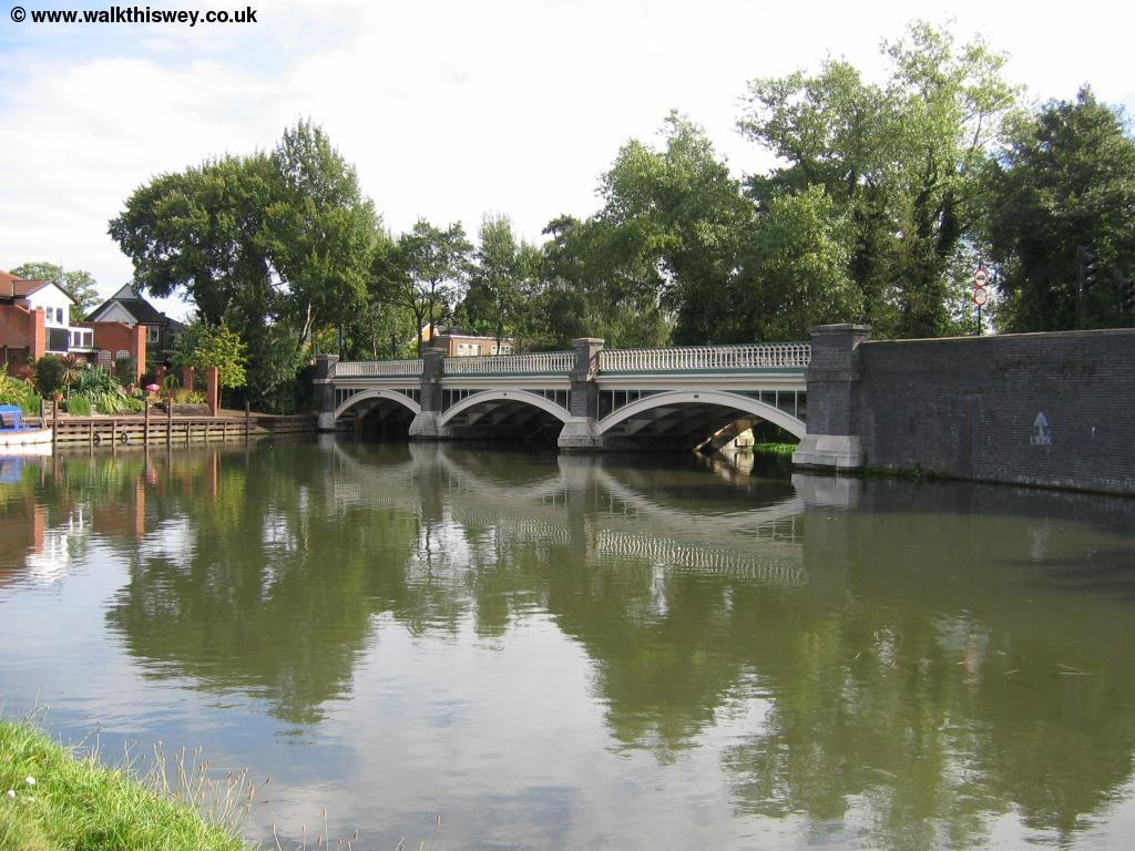 |
|
| The Wey Bridge |
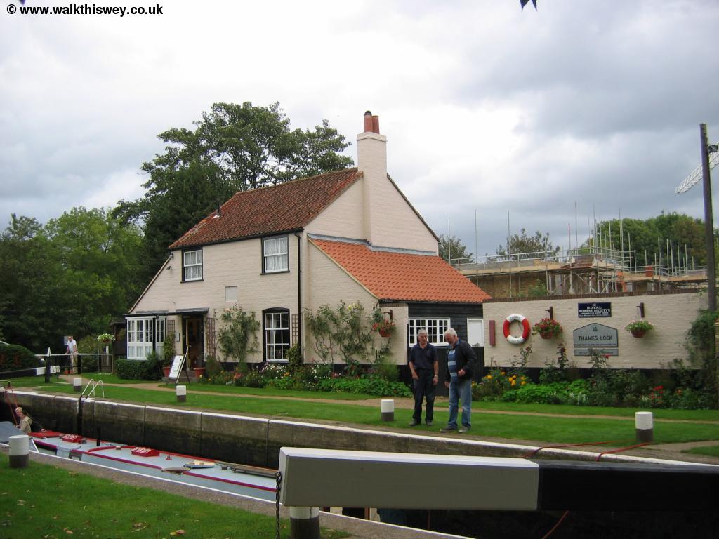
Beyond the bridges of the town the path continues on the left hand bank of the river. To the right are some impressive large houses, whilst the left hand bank of the river is wooded. Soon you find a weir on the left where the river appears to divide so this part of the path you have water on both sides! Soon you come to the final lock on the river, Thames Lock. Here there is a hut with some information posters and a small shop in the lock cottage across the river. Here the towpath of the Wey comes to something of an abrupt halt and you have to walk round onto roads where new houses are being built to emerge into Thames Street. Here you turn left to get to the mass of water where the Wey meets the Thames. It's difficult to tell which river is which here, as not only are there the two rivers, but also two islands. The Thames path crosses the river on a ferry here (where you have to ring a bell to summon the ferry) continuing on the Shepperton side of the river.
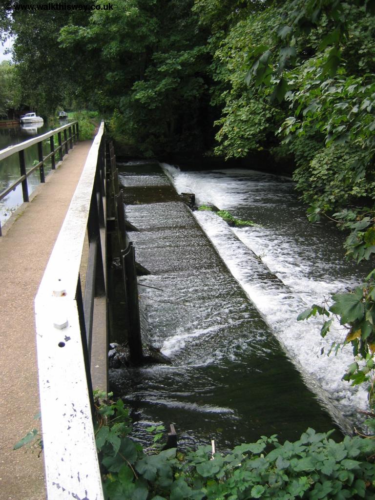 |
 |
| The weir near Thames Lock | Approaching Thames Lock |
 |
|
| Thames Lock |
Getting Back
Public transport is a bit limited from Thames Lock. The best option is to re-trace your steps to the town bridge where there are normally buses every hour (Monday - Saturday) back to West Byfleet although there doesn't appear to be a service on Sundays. An alternative is to walk back to the town bridge the head towards the town centre, turning right into Church Street. Continue on this road and you'll come to Weybridge station (some distance from the town). From here trains run at least every 30 minutes to West Byfleet. From West Byfleet buses run hourly (Monday - Saturday) back to Pyrford (passing the end of Lock Lane, the road to the lock).
If you have a long wait for the bus or it's not running, head straight ahead to the main road which you cross into Pyrford Road. Continue down this road, turning left into Dodd's Lane. Follow the path from the end of this road to rejoin the river at Dodd's Bridge, a short walk from Pyrford Lock.
Links
The following web sites provide information on the area.
Every effort is made to ensure the accuracy of information on this site, but liability will not be assumed in the event of any inaccuracies. Use of the information on this site is at your own risk. If you find any errors, please use the link below. The text and photographs on this web site are all Copyright © and may not be reproduced without prior permission.